Exploring Mapbox integration in OAC 6.2

Mapbox has risen in aiding numerous businesses with its high-performance platform, delivering real time mapping by collecting and processing live anonymous sensor data from users globally. OAC 6.2 was released with some Mapbox integrated features, meaning it was time to test them.
One of Mapbox’s many use cases, Vaccines.gov, devised a web application using Mapbox GL JS informing Americans of their nearest Covid-19 vaccination centres. Whilst experimenting with Mapbox in OAC, I also happened to use a Covid-19 dataset to plot some vaccinations statistics across the world. I was intrigued to see whether OAC could enable me to execute similar animations to the web application. So, I followed a video Oracle uploaded on their YouTube channel to get a gist of the features to test.
The process
This sample dataset I found on Kaggle is updated daily from the ‘Our World in Data’ GitHub repository and merged with a locations data file to distinguish the sources of these vaccinations. I imported them into DV and carried out a quick clean on a few variables I was intended to plot on a simple map visual; I replaced all null values with 0 for total_vaccinations and daily_vaccinations. I noticed the country variable was understandably being treated as an attribute, and the cleaned variables as numbers, which would help visualise the distributions easily with colour gradient scales.
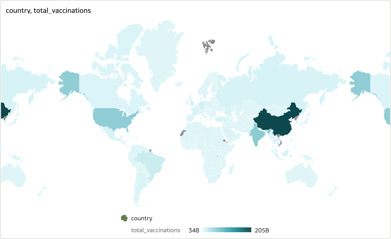
First, I plotted a map using country under the Location category, and total_vaccinations under Colour.

The data is presented clearly on the map, and I could zoom in and out of specific locations seamlessly with a simple hover-and-zoom. Following the video, I added another visual depicting a table enlisting the countries and vaccines registered by each.
By selecting each field in this table, you can see the relevant country is highlighted. The first feature is the ‘Zoom to Selected’ option which directly zooms into the country of interest and can be found in the top-right menu of the map visual. Since country is only an attribute without geospatial coordinates, using the Layer Type ‘Point’ just centred the point within the country space, so leaving it as a ‘Polygon’ did not make a difference.

Now for the more interesting feature, enabling the ‘Use As Filter’ on the top-left icon of the table allows for automatic zooming into the map as different fields are selected. However, you need to ensure the ‘Auto Focus on Data’ feature under ‘Map’ properties is toggled on in order to see the automatic zoom functioning well; else, the map will remain static where you left off whilst other regions will be highlighted but not shown. In addition, I experimented with some map coordinates from Kaggle that looked at statistics regarding rainfall-triggered landslides across America. I realised the latitude/longitude coordinates had to be treated as an attribute (like country above) in order to accurately plot them.

Limitations
You can also add other map backgrounds to the options listed, including OracleStreetMap, Oracle BI, Oracle Maps. From Google Maps, Baidu Maps, Web Map Service, and Tiled Web Map users can only utilise the MapView library with the first two options due to legalities.
Also worth mentioning, working with Mapbox library in OAC on an older laptop and an older version of a browser may slow down loading times of visualisations in the canvas due to some fairly intensive JavaScript.
Conclusions
Overall, the Mapbox integration in OAC can execute impressive animations around accurate geospatial data, similar to many of its business use cases today. The zoom feature is seamless and helps locate areas of interest quickly to extract relevant information. There are also various map theme options to suit visualisation needs for the data you are working with.
Find out how OAC can help your business. Contact us today.